
In recent years, there has been a significant advancement in the field of Artificial Intelligence (AI) and Augmented Reality (AR). These technologies have become increasingly popular and have the potential to enhance virtual experiences in various fields such as gaming, education, healthcare, and...
A Digital Oceanographer Maps the Seabed Using Sound Reflection
59
14.06.2026
Why mapping the ocean floor is difficult
Most of the ocean floor remains harder to observe than the surface of Mars. Light does not penetrate deep water, and satellite imaging cannot directly capture underwater terrain.
As a result, scientists rely on indirect methods—primarily sound—to study seabed structures across vast and inaccessible regions.
This makes ocean mapping a data-intensive and computationally complex task.
What a digital oceanographer does
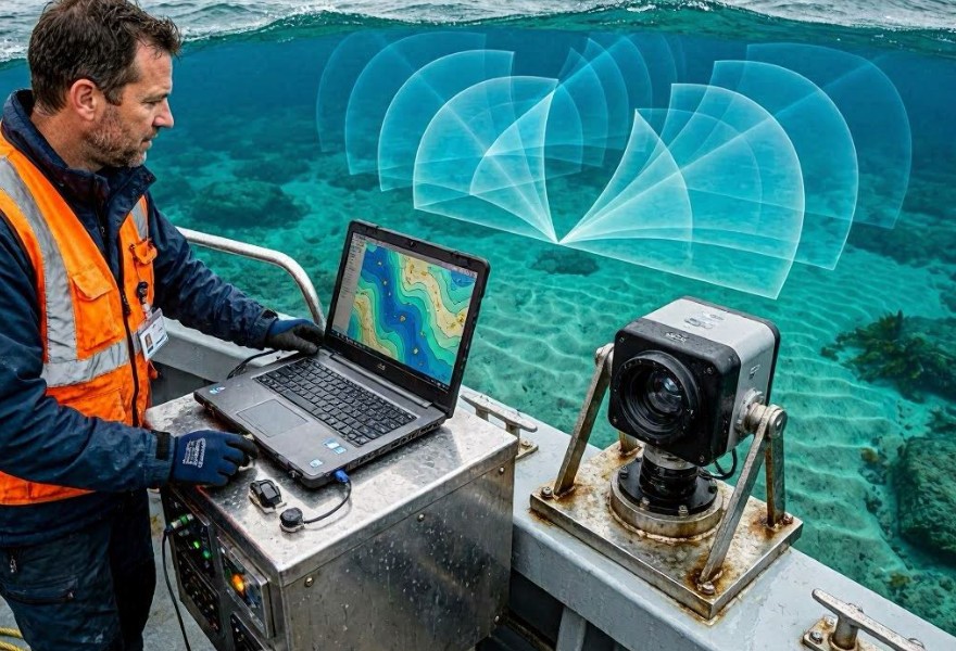
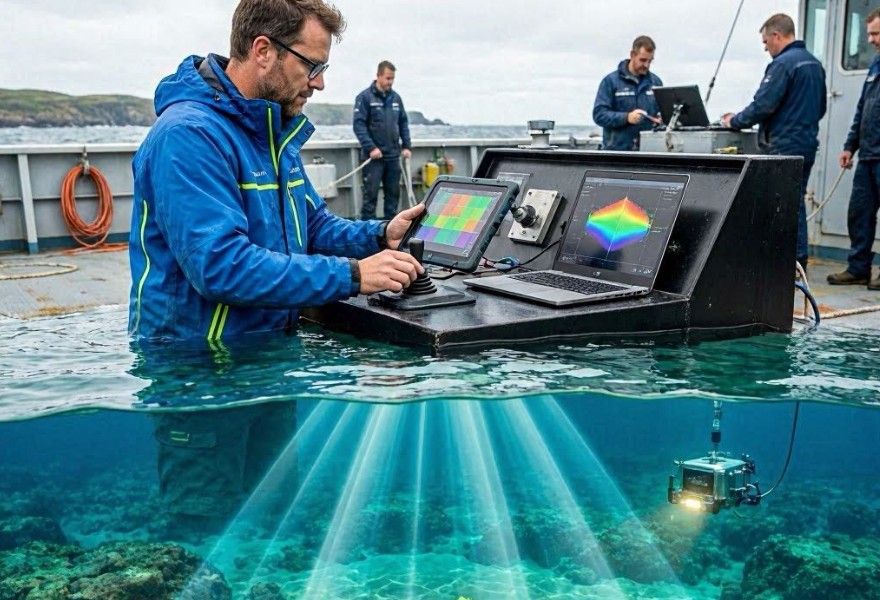
A digital oceanographer is an AI-driven system that processes underwater acoustic data to reconstruct the shape and composition of the seabed. It turns sonar signals into high-resolution topographic maps.
Instead of manual interpretation, the system continuously analyzes and refines ocean floor models in real time.
Main data sources
- Multibeam sonar readings from ships
- Autonomous underwater vehicle (AUV) sensors
- Seismic reflection data
- Ocean current and density models
How sound reflection mapping works
Sonar systems emit sound pulses that travel through water, bounce off the seabed, and return to sensors. The time and intensity of these echoes reveal information about depth and surface structure.
By analyzing millions of these reflections, the system builds a detailed representation of underwater terrain.
Mapping workflow
- Emission of acoustic signals
- Recording of return echoes
- Conversion of time delays into depth measurements
- Integration of overlapping scan paths
- Generation of 3D seabed models
Role of artificial intelligence in ocean mapping
Machine learning models help clean noisy sonar data and fill gaps where direct measurements are missing. They can infer missing terrain features based on surrounding patterns and known geological structures.
AI also improves classification of seabed types such as sand, rock, coral, or sediment.
Key analytical tasks
- Noise reduction in sonar signals
- Depth estimation correction
- Seafloor feature classification
- 3D surface reconstruction
Why AI improves seabed mapping
Traditional ocean mapping requires extensive manual processing and interpretation of sonar data. AI systems can process large-scale datasets much faster and identify subtle patterns that may be missed by human analysts.
This enables more continuous and higher-resolution mapping of the ocean floor.
Applications of seabed maps
Main uses
- Navigation and maritime safety
- Undersea cable and pipeline planning
- Earthquake and tectonic research
- Marine ecosystem studies
Limitations of acoustic mapping
Sound waves can be affected by water temperature, salinity, and pressure, which may distort measurements. Deep or complex terrains may also produce ambiguous reflections.
In some cases, supplementary data from physical sampling or visual inspection is still required for validation.
Future of digital oceanography
Future systems may combine sonar, satellite gravimetry, and autonomous underwater drones to create continuously updated global seabed maps with near-real-time accuracy.
Conclusion
AI-powered oceanography transforms acoustic signals into detailed maps of the seabed, enabling deeper understanding of Earth’s least explored environment.