
In recent years, there has been a significant advancement in the field of Artificial Intelligence (AI) and Augmented Reality (AR). These technologies have become increasingly popular and have the potential to enhance virtual experiences in various fields such as gaming, education, healthcare, and...
An Algorithm Helps Firefighters Build Safe Evacuation Routes
90
30.05.2026
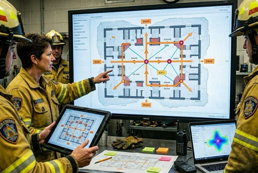
Why evacuation planning is a critical challenge
During emergencies such as wildfires, chemical leaks, or large urban fires, conditions can change rapidly. Roads may become blocked by flames, smoke, debris, or structural collapse.
Firefighters and emergency coordinators must make fast decisions under uncertainty, balancing speed, safety, and accessibility for large populations.
Traditional planning methods rely on static maps and human judgment, which can be overwhelmed in fast-moving situations.
How the evacuation routing algorithm works
The system uses real-time data and predictive modeling to calculate safe evacuation paths. It continuously updates route recommendations as conditions evolve on the ground.
Instead of treating roads as fixed infrastructure, the algorithm models them as dynamic networks with changing risk levels.
Key data inputs
- Live fire front or hazard location data
- Traffic flow and congestion levels
- Road closures and infrastructure damage reports
- Weather conditions such as wind and smoke direction
- Population density and evacuation demand
How safe routes are calculated
The algorithm assigns a risk score to each road segment based on proximity to danger zones and predicted hazard movement. It then searches for paths that minimize overall risk while maintaining reasonable travel time.
This is typically modeled as a dynamic shortest-path optimization problem under changing constraints.
Route computation process
- Mapping of current hazard zones
- Risk scoring of transportation network
- Graph-based path optimization
- Continuous re-evaluation as conditions change
- Distribution of updated routes to responders

Role of predictive modeling
Machine learning models help forecast how fires or hazards will spread based on wind, terrain, and fuel availability. This allows the system to anticipate which routes may become unsafe in the near future.
By incorporating prediction rather than only current conditions, evacuation planning becomes more proactive.
How firefighters use the system in practice
The algorithm does not replace human decision-making. Instead, it provides decision support tools that help incident commanders evaluate multiple evacuation scenarios quickly.
Recommended routes can be sent to mobile devices, emergency dashboards, or public alert systems.
Operational applications
- Designing evacuation zones during wildfires
- Routing civilians away from hazardous areas
- Guiding emergency vehicle access paths
- Updating plans in real time during incidents
Advantages of algorithm-assisted evacuation planning
Main benefits
- Faster response time in emergencies
- Improved safety through dynamic rerouting
- Reduced risk exposure for civilians and responders
- Better coordination across agencies
Limitations and real-world constraints
Even advanced systems depend on the quality and availability of real-time data. Communication failures, sensor gaps, or rapidly changing conditions can reduce accuracy.
Human judgment remains essential, especially in situations where data is incomplete or conflicting.
Future of AI in emergency management
Future systems may integrate drone surveillance, satellite imaging, and autonomous ground robots to provide even more precise real-time mapping of disaster zones.
Conclusion
AI-driven evacuation routing systems enhance firefighting operations by transforming complex, fast-changing environments into actionable plans that improve safety and decision-making during crises.